Category:Photos by VIIRS
Jump to navigation
Jump to search
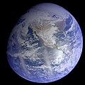
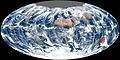
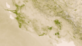
These satellite images were created using the Visible Infrared Imaging Radiometer Suite (VIIRS), an instrument that collects infrared and visible light data on board the Suomi NPP earth orbiting spacecraft that was launched in 2011.
spacecraft instrument | |||||
| Upload media | |||||
| Instance of | |||||
|---|---|---|---|---|---|
| Part of | |||||
| Manufacturer | |||||
| Mass |
| ||||
| official website | |||||
| |||||
Subcategories
This category has the following 2 subcategories, out of 2 total.
S
T
Media in category "Photos by VIIRS"
The following 132 files are in this category, out of 132 total.
-
 Northwestern Europe at night by VIIRS.jpg 2,000 × 2,000; 1.3 MB
-
 Korea and the Yellow Sea at night by VIIRS.jpg 4,000 × 4,000; 4.02 MB
-
 India at night from space during Diwali 2012.jpg 4,218 × 4,218; 4.53 MB
-
 The Nile River Valley and Delta.jpg 3,000 × 3,000; 2.08 MB
-
 Western North America at night by VIIRS.jpg 13,500 × 13,500; 9.25 MB
-
 Atlantic continents at night by VIIRS.jpg 13,500 × 13,500; 10.05 MB
-
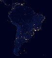
 South America and Antarctica at night by VIIRS.jpg 13,500 × 13,500; 6.95 MB
-
 Europe, North Africa and Western Asia at night by VIIRS.jpg 13,500 × 13,500; 21.73 MB
-
 India at night by VIIRS (cropped).jpg 3,756 × 4,807; 3.97 MB
-
 Southern India at night by VIIRS (cropped).jpg 1,405 × 1,404; 460 KB
-
 Southern Africa and Antarctica at night by VIIRS.jpg 13,500 × 13,500; 4.36 MB
-
 China at night by VIIRS.jpg 1,610 × 1,158; 1.52 MB
-
 East Asia at night by VIIRS.jpg 5,568 × 3,836; 7.76 MB
-
 India at night by VIIRS (cropped) 1.jpg 1,190 × 1,264; 959 KB
-
 Korea at night.jpg 720 × 480; 154 KB
-
 Megalópole Rio SP.jpg 291 × 173; 59 KB
-
 Megalópole Rio–SP.jpg 895 × 699; 480 KB
-
 North America night.jpg 3,877 × 2,694; 4.09 MB
-
 Samerica vir 2012202 lrg.jpg 523 × 382; 103 KB
-
 South America night.jpg 2,447 × 2,750; 2.16 MB
-
 South India at night by VIIRS.jpg 501 × 421; 124 KB
-
 Southern Cone at night.jpg 1,210 × 1,416; 804 KB
-
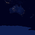 Australasia and Antarctica at night by VIIRS.jpg 13,500 × 13,500; 4.78 MB
-
 Light pollution US map.jpg 3,023 × 1,311; 1.53 MB
-
 The earth at night (2).jpg 13,009 × 6,750; 12.32 MB
-
 The earth at night.jpg 13,500 × 6,750; 7.45 MB
-
 2016FortMcMurrayWildfireNASA2.png 985 × 681; 286 KB
-
 2020augderecho-suomi-outages-animated.gif 1,200 × 601; 2.06 MB
-
 2022-12 black NOAA21FirstGlobal CenterRobinsonProjection Upton v2.png 1,920 × 1,040; 3 MB
-
 A Deadly Eruption Rocks Guatemala June 3, 2018.png 716 × 542; 508 KB
-
 A Deadly Eruption Rocks Guatemala, acquired June 3, 2018.png 720 × 1,028; 1.22 MB
-
 A Deadly Eruption Rocks Guatemala, June 3, 2018.png 720 × 480; 666 KB
-
 Africa and Eurasia at night 2012.jpg 2,720 × 3,760; 1.46 MB
-
 Africa from low orbiting satellite Suomi NPP.jpg 11,500 × 11,500; 11.04 MB
-
 Alberta Wildfire 2016-05-03 2025Z.jpg 536 × 408; 37 KB
-
 Alberta Wildfire 2016-05-04 2005Z.jpg 536 × 672; 90 KB
-
 Alberta Wildfire 2016-05-05 1945Z.jpg 672 × 536; 127 KB
-
 Alberta Wildfire 2016-05-06 1930Z.jpg 2,672 × 3,472; 2.42 MB
-
 Alberta Wildfire 2016-05-16 1940Z.jpg 1,608 × 1,208; 340 KB
-
 Alberta Wildfires 2016-05-15 2000Z.jpg 3,336 × 4,272; 3.09 MB
-
 AMS in New Orleans, Louisiana (24582580726).png 2,048 × 1,152; 3.3 MB
-
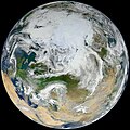
 Arctic from low orbiting satellite Suomi NPP.jpg 2,048 × 2,048; 2.11 MB
-
 August2020midwestderecho-outagecomparison.jpg 11,990 × 6,315; 4.75 MB
-
 Auroras over North America.jpg 3,677 × 3,677; 2.05 MB
-
 Australia vir 2016007 lrg.jpg 2,272 × 1,736; 781 KB
-
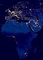
 Black Marble - Africa, Europe, and the Middle East (8247962102).jpg 8,192 × 8,192; 2.12 MB
-
 Black Marble - City Lights 2012 (8246892319).jpg 1,920 × 1,080; 155 KB
-
 Black Marble Americas.jpg 8,192 × 8,192; 1.47 MB
-
 BlackMarble20161km.jpg 43,200 × 21,600; 266.4 MB
-
 Blue Marble 2012 - 'White Marble' Arctic View (7394700302).jpg 11,000 × 11,000; 11.21 MB
-
 Blue Marble, Eastern Hemisphere March 2014 (14990033062).jpg 3,840 × 2,160; 1.16 MB
-
 Blue Marble.jpg 1,600 × 1,200; 275 KB
-
 Calbuco Volcano Erupts in Southern Chile (17069352359).jpg 2,048 × 1,152; 784 KB
-
 Chaparrastique Volcano Eruption Captured by Satellite.png 1,920 × 1,080; 1.25 MB
-
 City Lights 2012 - Flat map crop.jpg 11,358 × 6,075; 5.11 MB
-
 City Lights 2012 - Flat map.jpg 12,150 × 6,075; 2.64 MB
-
 City Lights of Greater Manaus.jpg 565 × 459; 126 KB
-
 Colorful Multispectral Imagery of the Aral Sea (24270793842).jpg 1,920 × 1,080; 608 KB
-
 Comparison of Earth and Moon size experiments 2.jpg 2,050 × 2,050; 602 KB
-
 Composite map of the world 2012.jpg 3,600 × 1,800; 776 KB
-
 Dust storm 2016-08-16 1545Z.jpg 12,008 × 7,736; 17.95 MB
-
 Dust Storm Red Sea Suomi NPP VIIRS July 25 2016 (28515744541).jpg 1,530 × 2,048; 1.47 MB
-
 Earth (32559435274).jpg 1,024 × 1,024; 592 KB
-
 Earth (32559435514).jpg 1,024 × 1,024; 406 KB
-
 Earth (32588063773).jpg 1,024 × 1,024; 546 KB
-
 Earth (32588064083).jpg 1,024 × 1,024; 797 KB
-
 Earth (33402087705).jpg 1,024 × 1,024; 568 KB
-
 Earth (36022366223).jpg 2,048 × 1,166; 1.15 MB
-
 Earth (36708117201).jpg 2,048 × 2,048; 2.58 MB
-
 Earth - March 9 2017 (33240239201).jpg 1,024 × 1,024; 747 KB
-
 East Coast Blizzard 2016 (25999390906).png 2,048 × 1,152; 3.81 MB
-
 Eastern US storm Aug 12 2014 Suomi NPP.png 2,048 × 1,152; 4.4 MB
-
 ErdebeiNacht2Hölzel.png 1,878 × 940; 1.1 MB
-
 Everglades - Green earth.png 1,920 × 1,080; 1.13 MB
-
 Fires in the Pacific Northwest (24011235669).jpg 1,024 × 576; 177 KB
-
 First Global Image from VIIRS (6538068229).jpg 3,360 × 1,680; 2.4 MB
-
 Greater Manaus at night.jpg 565 × 459; 87 KB
-
Green- Vegetation on Our Planet (Spinning Earth).webm 1 min 14 s, 1,280 × 720; 8.38 MB
-
Green- Vegetation on Our Planet (Tour of Earth).webm 5 min 16 s, 1,280 × 720; 55.58 MB
-
 Happy Camp Complex Fire 2014-09-03 2030Z EVL.png 2,048 × 1,152; 2.81 MB
-
 Herbal Earth - Eastern Hemisphere (9083656321).jpg 800 × 450; 143 KB
-
 Iran - Green earth.png 1,920 × 1,080; 1.04 MB
-
 Iraq - Green earth.png 1,920 × 1,080; 3.17 MB
-
 Israel at night.jpg 425 × 934; 174 KB
-
 January 2016 United States winter storm aftermath 2016-01-24 0655Z.jpg 2,408 × 3,136; 1.43 MB
-
 Korea at night.png 2,584 × 2,522; 5.13 MB
-
 Korean Peninsula at night from space.jpg 1,345 × 1,452; 353 KB
-

-
 Lunar Eclipse 2017-08-07 1900Z.jpg 2,276 × 3,777; 1.46 MB
-
 Luzes noturnas do arranjo urbano-regional de Salvador.jpg 567 × 329; 70 KB
-
 Map of Australia night sky 2016.jpg 5,717 × 4,250; 7.41 MB
-
 March 2014 nor'easter 2014-03-26.jpg 6,255 × 6,255; 13.85 MB
-
 Marie 2014-08-24 VIIRS.jpg 2,700 × 3,600; 2.92 MB
-
 Mati listrik Jawa 2019-08 VIIRS.gif 750 × 600; 949 KB
-
 MississippiDelta - Green earth.png 1,920 × 1,080; 3.12 MB
-
 NASA satellite view of Southern Ocean phytoplankton bloom (crop).jpg 841 × 598; 605 KB
-
 NASA satellite view of Southern Ocean phytoplankton bloom.jpg 1,740 × 2,545; 2.23 MB
-
 NASA Suomi NPP Satellite Sees Atmospheric Aerosols, Dust and Clouds (8033711634).png 1,440 × 720; 2.07 MB
-
 NASA's NPP Satellite Acquires First VIIRS Image (6385182023).jpg 5,989 × 5,892; 7.66 MB
-
 NASA's NPP Satellite Acquires First VIIRS Image (6385184555).jpg 3,111 × 5,155; 13.48 MB
-
 NASA.EOS.79810.Suomi NPP night bakken.vir 2012317.jpg 720 × 480; 153 KB
-
 Nebraska - Green earth.png 1,920 × 1,080; 3.85 MB
-
 Night lights 2012-the black marbel.jpg 1,920 × 1,080; 146 KB
-
 NileDelta - Green earth.png 1,920 × 1,080; 2.46 MB
-
 Nor'easter Pounds New England (16196567038).jpg 2,500 × 2,500; 3.93 MB
-
 North Africa and Europe from Suomi NPP - NASA Earth Observatory.jpg 10,000 × 10,000; 8.97 MB
-
 North America from low orbiting satellite Suomi NPP.jpg 8,000 × 8,000; 16.43 MB
-
 North India dust vir 2018165 large.jpg 6,997 × 4,665; 24 MB
-
 North India dust vir 2018165.jpg 720 × 480; 388 KB
-
 Northwestern Europe at night by VIIRS cropped marking Calais.jpg 333 × 355; 64 KB
-
 Northwestern Europe at night by VIIRS cropped to GB.jpg 361 × 378; 54 KB
-
 Old Night Vision Meets New (8247956644).jpg 720 × 813; 277 KB
-
 Saharan Dust Over Eastern Atlantic Ocean (24083379000).jpg 2,048 × 1,152; 362 KB
-
 Salvador at night by VIIRS.jpg 567 × 329; 108 KB
-
 Sea of Japan polar low 2015-11-26 0450Z.jpg 3,400 × 2,550; 3.46 MB
-
 Sea of Japan polar low 2018-01-11 0340Z.jpg 4,000 × 3,000; 3.6 MB
-
 Siberiaweek25 - Green earth.png 1,920 × 1,080; 3.1 MB
-
 Siberiaweek30 - Green earth.png 1,920 × 1,080; 3.1 MB
-
 Smog in Eastern China (25752492040).png 2,048 × 1,152; 2.65 MB
-
 Southern Africa 2017 04 19 (33299354754).jpg 4,146 × 4,144; 4.41 MB
-
 Suomi NPP in PlanetMaker (16797628149).jpg 1,920 × 947; 278 KB
-

-
 The Lights of London (15472779199).jpg 2,000 × 2,000; 1.29 MB
-
 Twin polar lows 2016-02-26 0425Z.jpg 1,800 × 2,400; 1.58 MB
-
 United States 2016-01-22 0730Z.jpg 2,408 × 3,136; 926 KB
-
 US East Coast VIR 2011326 large.jpg 5,986 × 5,947; 4.3 MB
-
 View of Earth showing the Arctic, Europe, and Asia.jpg 12,000 × 12,000; 36.77 MB
-
 VIIRS First Light - NASA Earth Observatory.jpg 720 × 720; 271 KB
-
 VIIRS view of the 2021 Suez Canal obstruction.jpg 720 × 480; 80 KB
-
 Wildfire in Fort McMurray, Alberta, Canada May 25th 2016 (26649348513).jpg 1,753 × 2,048; 1.96 MB
-
 Yukon - Green earth.png 1,920 × 1,080; 4.34 MB
-
 Zona da Mata in Northeast at night by VIIRS.jpg 2,736 × 3,135; 1.84 MB


.jpg)
.jpg)


_1.jpg)


.jpg)


.png)


.jpg)
.jpg)


.jpg)
.jpg)

.jpg)


.jpg)


.jpg)
.jpg)
.jpg)
.jpg)
.jpg)
.jpg)
.jpg)
.jpg)
.jpg)
.png)


.jpg)
.jpg)


.jpg)


_-_Flickr_-_NASA_Goddard_Photo_and_Video.jpg)


.jpg)

.png)
.jpg)
.jpg)


.jpg)


.jpg)
.jpg)


.png)
.jpg)
.jpg)
.png)
.jpg)


.jpg)

